Using Augmented Reality to Communicate Climate Change Pressure on Vancouver Island Marmot Habitat
Dave McLaughlin
The Vancouver Island Marmot is a species on the brink. By 2004, fewer than 30 individuals remained in the wild, and although a captive breeding and release plan has brought that number closer to 200 today, climate change threatens to drastically shrink potential habitat for the species. Using augmented reality, viewers gain a comprehension of the dynamics at play which may cause the marmot to lose 97% of its potential habitat by the year 2080.
Using a recent iOS device (iOS 12 or newer), tap the small icon overlaid on the top-right of the images below to view the map in augmented reality. Clicking on the image from a desktop browser will download the USDZ file, which can be viewed in MacOS’ Preview app, and perhaps other programs. If you are unable to load the experience, follow the links at the bottom to view my presentation at NACIS 2020!
Many thanks to Larissa Thelin, who generously shared data from her research, published in The Canadian Geographer: The potential effects of climate change on the habitat range of the Vancouver Island marmot (Marmota vancouverensis)
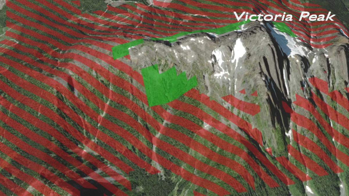
Victoria Peak
 This model is ~10MB will take a few moments to load
Looking at Victoria Peak, Vancouver Island’s third-highest point, we see that the marmot is constrained by elevation. Current potential habitat that will be lost by the year 2080 is symbolized in red stripes, while the small amount of habitat remaining is in the bright green.
As the climate on Vancouver Island warms, trees will advance to higher elevations, wiping out the alpine meadows the marmot needs for food, safety, and burrowing. The marmot can’t escape to higher elevations, because what’s left is only rock and ice, which cannot provide their home.
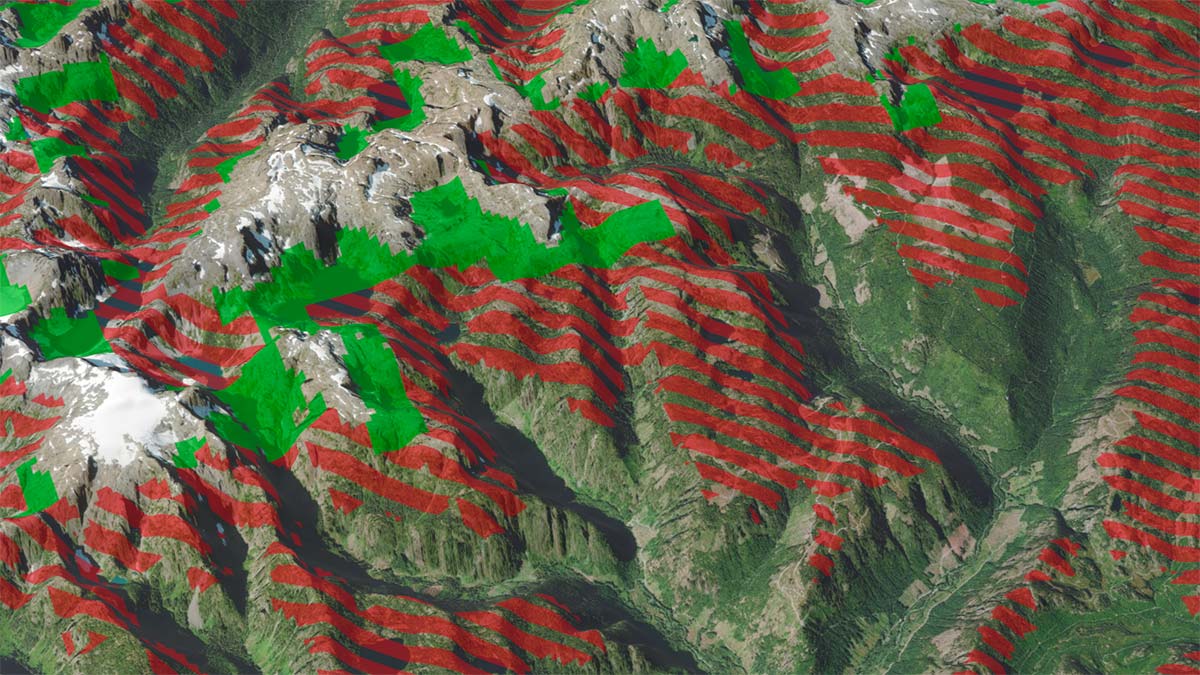
Strathcona Provincial Park
 This large model is ~31MB and will take at least a few moments to load
This map showing a section of the Elk River Mountains, part of the Vancouver Island Ranges, in Strathcona Provincial Park demonstrates the same effect playing out over a larger area. Future marmot habitat may be constrained to very small areas ringing the tops of the mountains.
Read the step-by-step guide to creating augmented reality web maps
Watch the presentation from NACIS 2020
View the slides from the NACIS 2020 presentation
Learn more about Dave McLaughlin